

Can Indians visit Pakistan for tourism?
PAKISTAN
Day 6: Swat Valley – Chilas
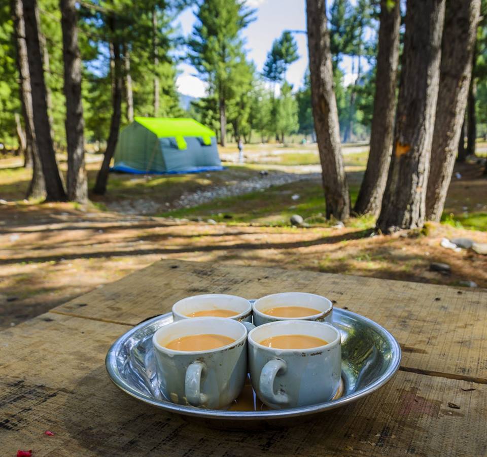
Falling raindrops on the windscreen and sunroof woke me up. The time was 05.30 hrs. It was pitch dark outside. Everyone seemed to be in their waterproof tents, sleeping peacefully. Other than falling raindrops noise, there was an eerie uncomfortable silence. Occasionally, there was a croak from toads in the campground as they welcomed rain gods. When my eyes got adjusted to the darkness outside, I could see river Panjkora gushing through the rocks and making its way. The rivers never get tired or what? I was itching for a hot tea but the barbecue fire had already extinguished. Soon it would be dawn. The temperature outside was 12°C, pretty cold already.
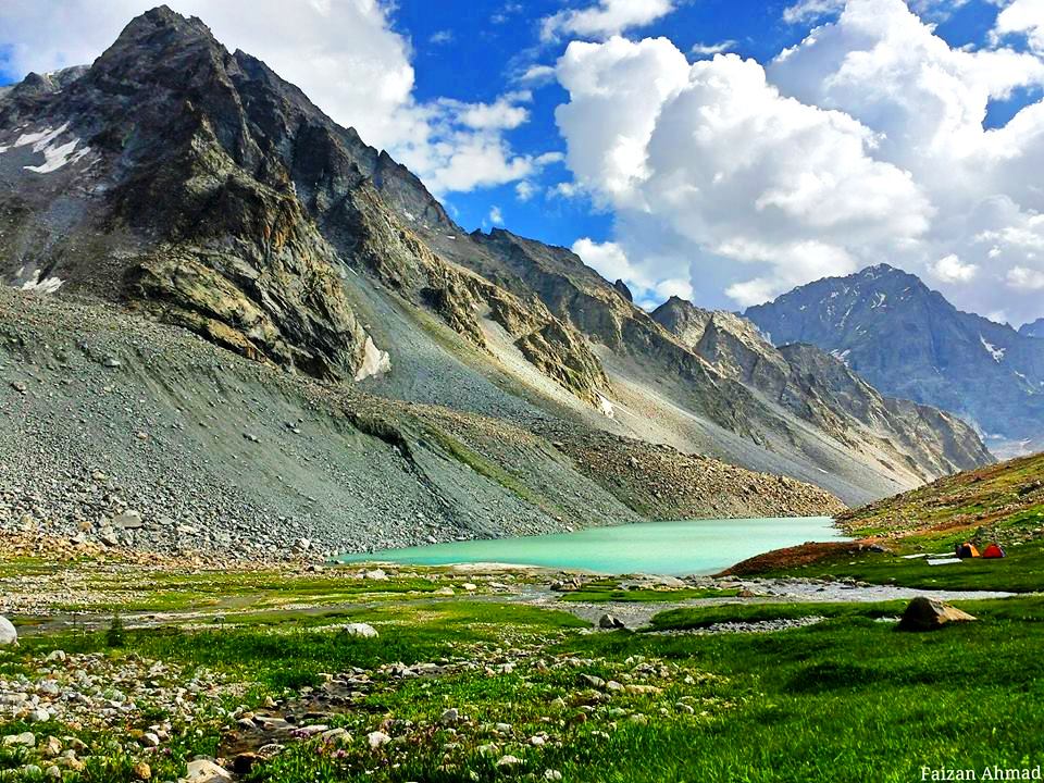
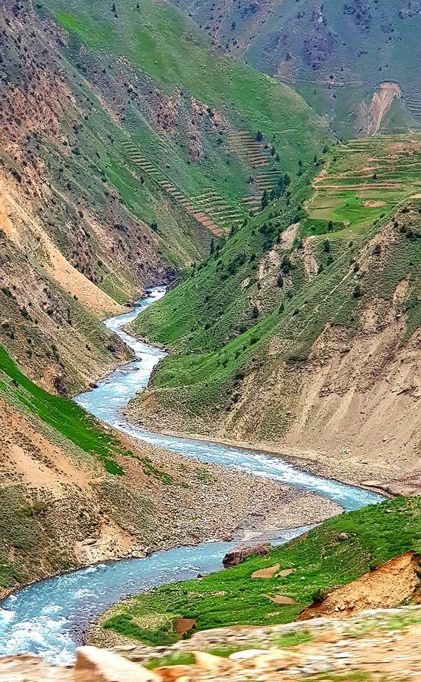
Kumrat Valley is situated in District Upper Dir KPK Pakistan & adjacent to Swat Valley and Chital Kalash Valley. Kumrat Valley and Swat Kohistan are connected via Badgoye Pass, while Kalash Valley is connected through Kashken Top. The Badgoye Top is also a Picnic Spot and containing Outsized and Lime Parklands. Jeep track is used to travel between Utror and Thall Kumrat Valley, which is very less explored due to many reasons as the bad road condition and lack of basic facilities. The valley is Lush Green with many Meadows & full of trees. The Kumrat Valley is the last border of Dir Kohistan. Dir Kohistan comprised of six villages’ i-e Patrak, Biyar ,Barikot ,Kalkot ,Lamoti and Thall.
Source of Information: https://blogs.tribune.com.pk/story/62973/kumrat-pakistans-magical-valley-that-will-keep-a-part-of-you-until-you-return-again/


I sat on the edge of a cliff by the side of the road overlooking the vast green expanse around. Nature has bestowed its choicest blessings on Kashmir, both to India and Pakistan. At a far distance, I could see herds of sheep grazing the grass along the Indus river. The sound of silence was really baffling my ears. It was very quiet there barring occasional sound of passing vehicle. Soon, sense dawned upon me and I resumed my journey. The sun started to set behind the mountains. November was showing its colors, the sun too desires to rest early now. While driving, I realized that I forgot to click pics over the break I took. That was the sole reason to make a stopover. Boy, not another one, I thought.
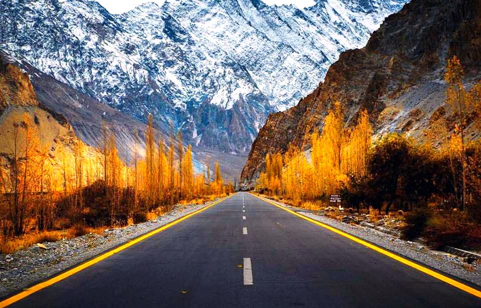
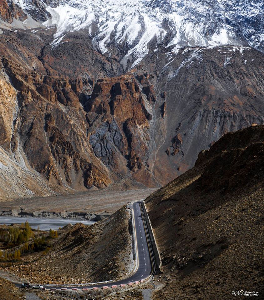
The serpentine Karakoram Highway is a beauty. No potholes, well marked, usually broad and passing through one of the most difficult stretches. At times, I longed for a company as driving full day without a company was boring. But at the same time, I perhaps, didn’t want to share the pleasure of driving with anyone. Also, I wished to be the first Indian to travel to Pakistan Northern areas with a tourist visa. My selfish needs kept me away from friends and family. Amidst these thoughts, I reached Sazin. There was absolutely nothing in Sazin, other than admiring nature. There were no markets, no bus stand…nothing. A shabbily makeshift dhaba was being run apparently by a local shepherd. I parked the car along the road and asked him for a cup of tea. I started a ‘guftagu’with him. He told me that after Karakoram highway was built, usually people don’t stop here to spend night. Instead, they prefer driving all the way to Chilas which was another 3 hrs away. I somehow, was late arriving here. Local time showed 20.00 hrs. It was getting cold and wind started blowing fast.Now, I had two options, either I could sleep in my car or I could pay Rs 50 per bed and sleep in his makeshift dormitory. I chose the latter as I didn’t want to sleep in car for two consecutive nights, but before sleeping, I had to fix my dinner. All the guy had to offer was a paratha with tea. A nice gesture, but not enough for the night. In my XUV trunk, I found some kokis and a jar of desi pickle, which was enough for dinner. At around 21.30 hrs, I slept.
Day 7: Sazin – Hunza Valley
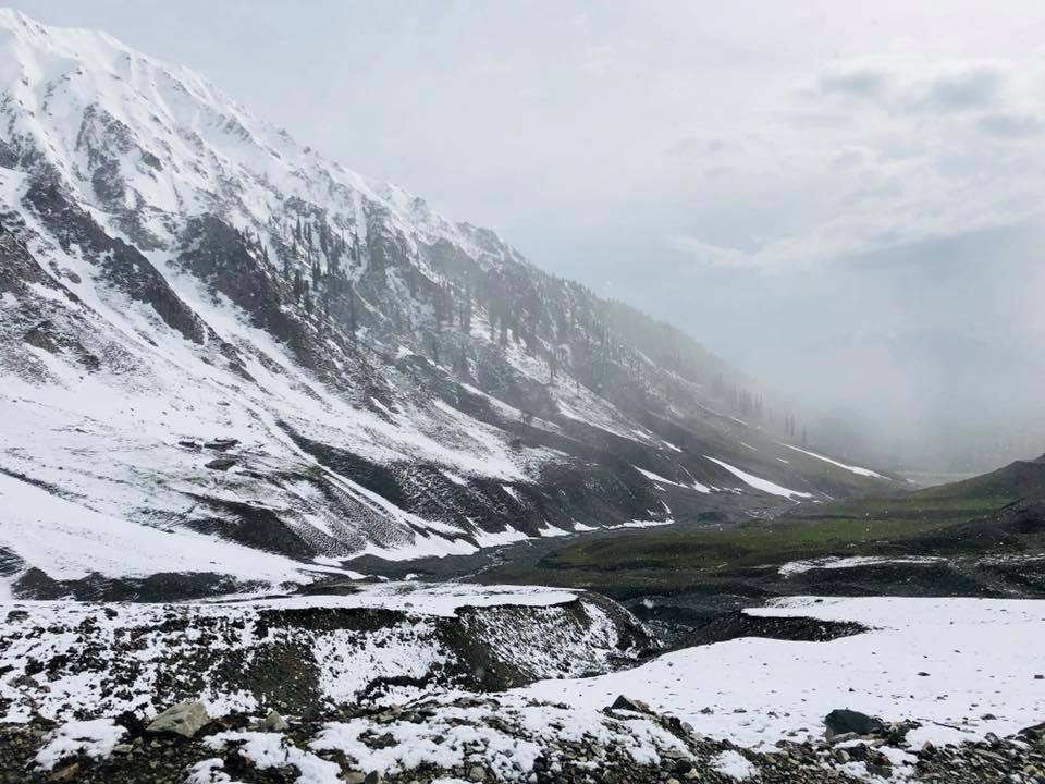
The streaks of sunlight coming from the back of mountain painted the sky crimson red. It was around 05.00 am but the visibility was clear. Early November morning air was cold and dry. I felt the need to wear a cap in addition to jacket. The dhaba guy was already up and preparing his stall. I requested him to prepare tea, while I got up to get ready. By 05.30 am, I was already on my way to Hunza Valley, which was about 8 hrs drive from here. The traffic was thin, road was excellent and weather was salubrious. XUV was already touching speed of 60 kmph on these treacherous roads. I knew it was a bit risky but deep in my heart I wanted to visit Babusar top (Elevation of 13690 ft) which was a one hour detour from Chilas. Speeding through Karakoram Highway saved me about 30 mins and I was at Chilas by 08.00 hrs. I got the XUV tanked up at the Total Petrol Pump and took N15 south to Babusar top.
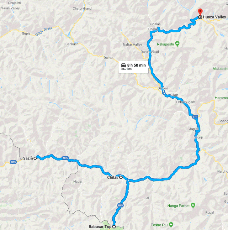
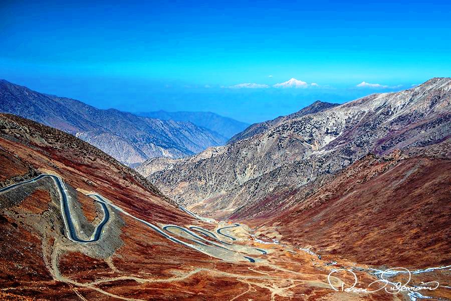
Babusar Pass connects Gilgit Baltistan with Khyber Pakhtunkhwa province of Pakistan. The quality of road immediately deteriorated and at times, it was sheer muddy road on which I was driving. However, the scenery got greener but the local traffic increased too. It took me around one hour to reach the Babusar top. The wind blowing was cool in spite of it being a sunny day. I stepped out of XUV and clicked few good pics of the place. At this hour, Babusar top wasn’t much crowded. The view of the valley around was mesmerizing.
This N15 highway goes up to Mansehra via Lulusar-Dudipastar National Park. I took a U-turn and started driving back.Time read 10.30 hrs when I reached Chilas. The places I wanted to cover in Hunza Valley were Rakaposhi Point, Karimabad, Altit fort, Baltit fort, Eagle’s Nest view point, Attabad Lake, Passu Cones, Rush Lake, Gojal Village and Sost Border. The time was short and hence I was not planning to spend more time at one particular attraction.
Source of Information: https://www.pakistantravelguide.pk/2016/11/06/places-to-visit-in-hunza-valley
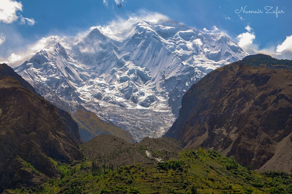
After driving for another 3.5 hrs non-stop on N35, The Karakoram Highway, I reached Rakaposhi View Point, which means ‘snow covered’ in local language. The view of snow capped Karakoram range from the highway was stunning.
Time read 14.00 hrs. There was a small shack serving kabab rolls. It being lunch time, I gleefully hogged onto it. I was told by the locals that Rush Lake is a full day trek and considering my paucity of time it would be wiser to drop it from my itinerary. For the rest of the day, I decided to cover both forts, Karimabad, Eagle’s Nest view point and Gojal village, if possible. I reached Altit fort by 15.00 hrs. The fort is huge with a big garden at the entrance. Lush green surroundings, manicured lawns and tranquil atmosphere creates magic. There is a small cafe serving delicious hot coffee. Overall, the Fort was charming.

I skipped the next fort as I was told that this one is more alluring. Time read 16.00 hrs when I left Altit fort. My next stop was Eagle’s Nest view point. I drove along a narrow lane for 6 km to reach the Eagle’s Nest view point.

There were many hotels nearby and I settled at Hunza Roof Hotel. It being November, there were no tourists. I was given a room with a view overlooking the valley. My DSLR was already working overtime. I had finished two memory cards already. Though I had to cover Gojal village today, as it was on the way to Attabad lake, I thought of covering it the next morning. It was almost 18.00 hrs. In last one week, this was the earliest I had reached a hotel. I ordered myself a tea, pulled a chair to the balcony and sat gazing at the mighty mountains in front of me. On the top of the mountains there seemed fresh snow at the top which was gleaming in golden yellow as sunrays fell on it. The wind was picking up and it was getting colder. The town was already quiet, turned silent as it turned dark outside. By the time I slept it was already 20.30 hrs, quite early by my standards, but this was the best use of extra time.
For tours and travel in Pakistan, you may connect with NARANKAGHANTOURS
Webpage: narankaghantours.com
Contact Number: +92 331 0331 304
To be continued…
Part 1:
Part 2:
Part 3:
Part 5:
Really excited .
I would like to join you some day.