

Can Indians visit Pakistan for tourism?
Pakistan
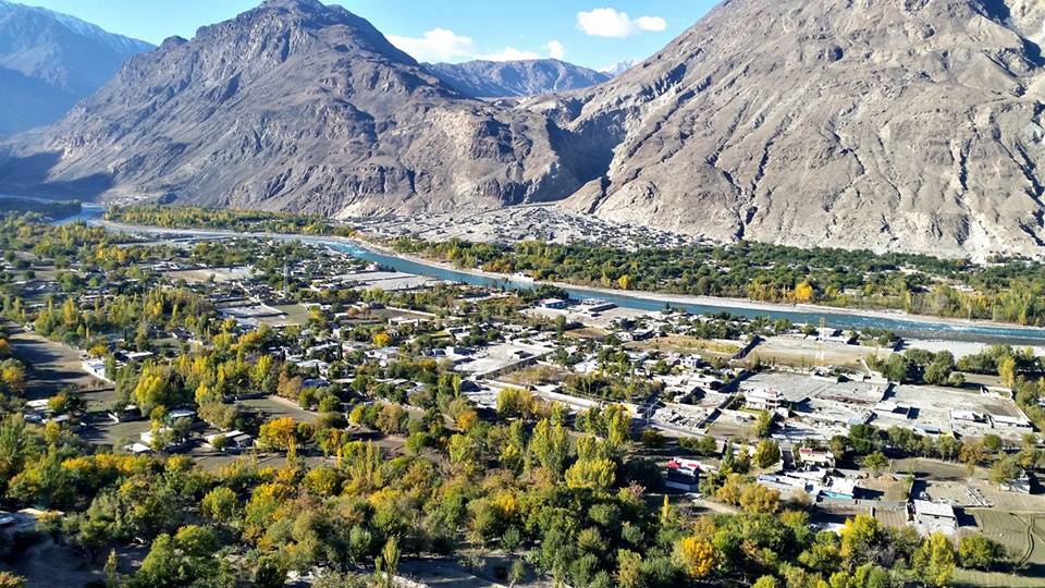
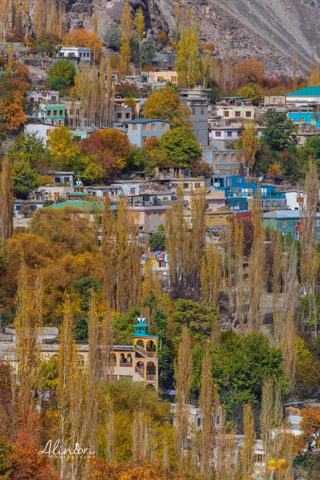
Day 8: Hunza Valley
I had a full day to explore the beautiful Hunza valley Pakistan – the plan of the day was to explore Gojal Village, Passu Cones, Attabad Lake, and if possible Sost Border. I discussed this plan with the owner of the hotel. He suggested that I include the Khunjerab pass located at the China border in my itinerary. This was about 4.5 hrs from my hotel.
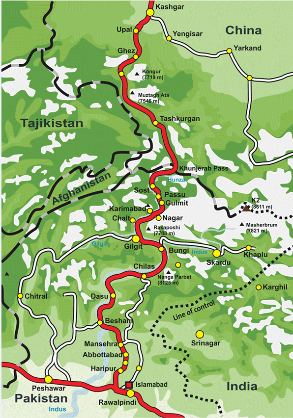
This would be Karakoram Highway at its best, or worst, in Pakistan. Passing through the world’s most unforgiving terrains, this would be a real test of XUV’s prowess and my expertise as a driver. It was morning 06.00 hrs when I left the hotel for the Khunjerab pass. I planned to cover Passu cones and Attabad lake while returning from the pass. The quality of the highway was amazing…butter smooth. I was already driving in the 60s. There were frequent twists and turns but the road wasn’t too narrow so it was easy to drive fast. Soon I drove past Attabad Lake, Passu, and Khyber. The tank and tummy were almost full and I didn’t stop at all as I wanted to reach Khunjerab pass on Pakistan side quickly. After continuous driving for 4 hrs, I reached the Pakistan–China border at an elevation of 16010 ft. At the top, it was cloudy and bone-chilling cold.
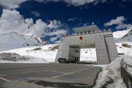
There is nothing to do other than click pics of the border gate and enjoy the weather. This place boasts of being the highest border crossing and having the highest ATM point in the world. I could feel AMS kicking in and me gasping for my breath. It was a wise decision to move to a lower elevation as a prolonged stay could have ruined my further plans. Time read 11.00 hrs when I started for Attabad Lake from Khunjerab pass. This time, I was driving slowly enjoying the Pakistan scenery around. Within two hours, I reach Sost Bazar which is the biggest market in the area. From here I purchased two carpets and some souvenirs for gifting purposes. The only issue is that most of the shops prefer dealing in cash only.
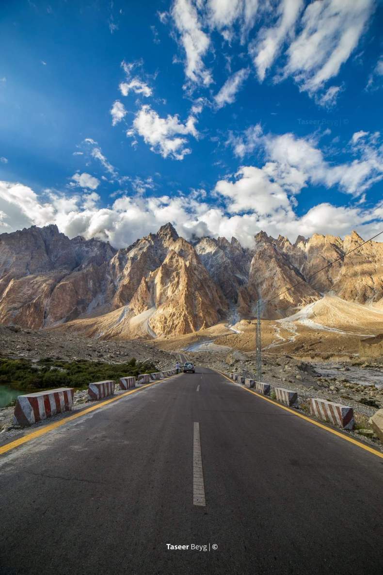
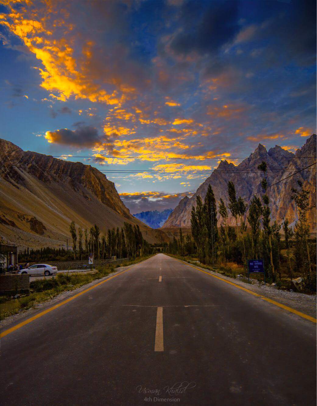
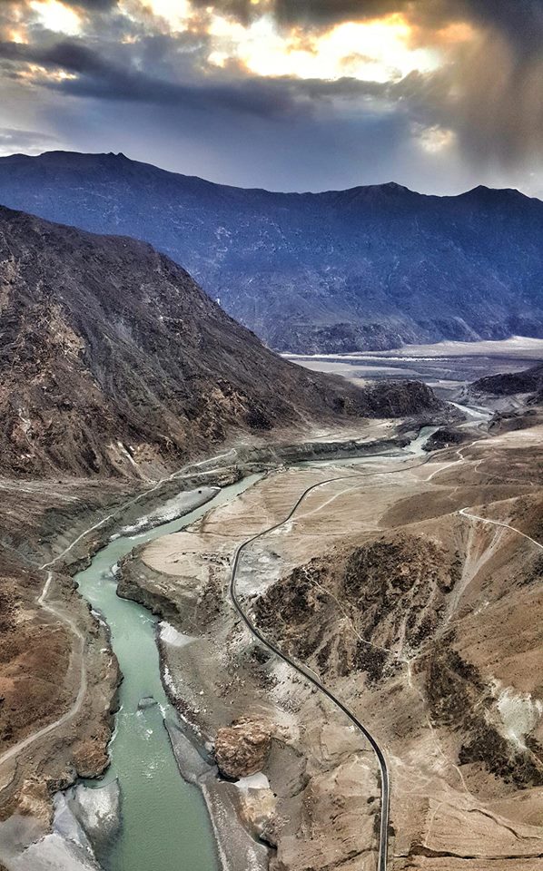
Hunza river was my constant companion from here. The picturesque scenery coaxed me to take my eyes off the road and soak in the panorama but I remembered the Besham City incident and continued driving with concentration. The temptation was too hard to resist and I finally stopped the car along the highway and just basked in the best of nature. The valley was amazingly beautiful with few trees showing fall colors. At a distance I could see a small waterfall too, making it a wow experience. My DSLR was engaged soon trying to capture all the shades of nature. Trust me, you can’t click a bad pic here. I wish I could have stayed back on the highway just absorbing nature but Passu Cones were waiting for me. They were still 30 mins drive from here. The serpentine road took me there in a jiffy. The local time read 13.30 hrs when I could see Passu cones in the backdrop.
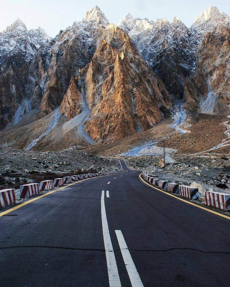
Only nature can paint this beauty. Imagine tall brown mountains resembling cones with the top covered in white snow, a blue sky, and well tarred Pakistan Karakoram Highway without traffic… now imagine all this in one picture frame… isn’t it a picture postcard? Nothing can beat this experience…nothing. The temperature outside was around 4 °C in spite of it being afternoon. It was so beautiful that I reversed my car and re-traveled this stretch for 3 km.
Passu Cones a succession of dozens of cone-like narrow peaks also known as Passu cathedral. Opposite the cathedral is Passu Sar, a snow-capped mountain and the glacier which forms its base in Pakistan.
Source of Information: https://urbanduniya.com/pakistantraveller/the-spectacular-unknown-passu-cones/
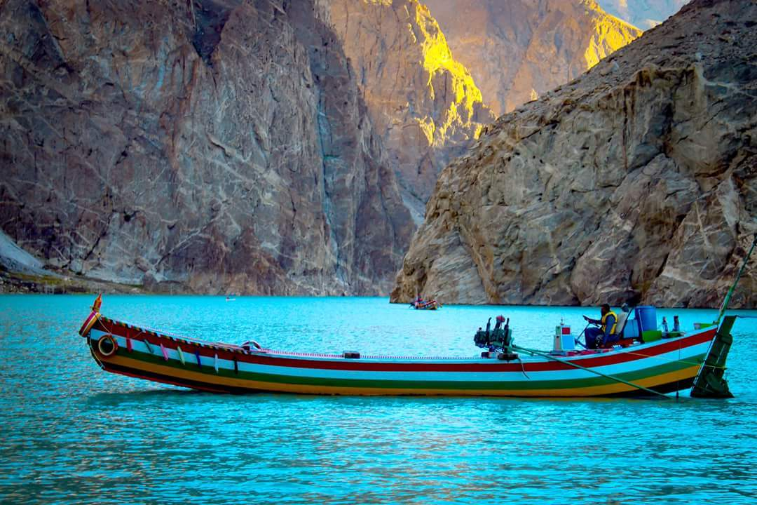
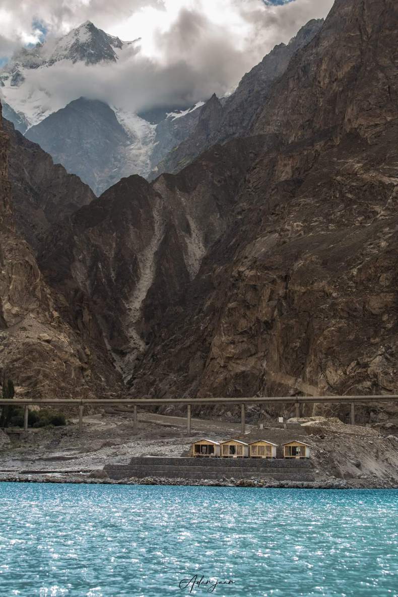
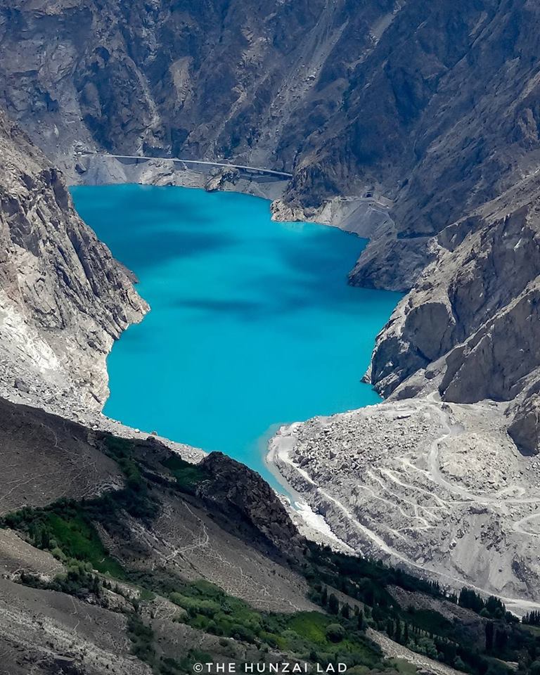
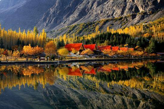
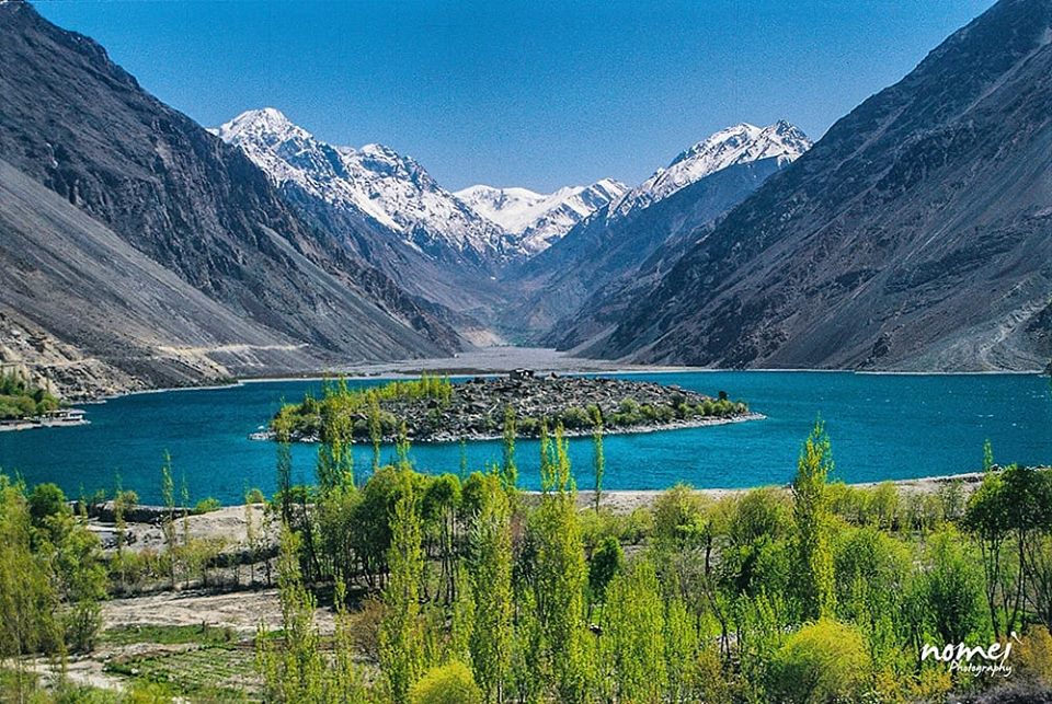
Attabad lake was formed due to a massive landslide at Attabad village in Hunza Valley in Gilgit-Baltistan, Pakistan, 9 miles (14 km) upstream (east) of Karimabad that occurred on 4 January 2010. At the time of its formation, the local residents had no idea that there would be a lake formed that would hold so much beauty and would become a famous destination for tourists. The lake connects the Hunza Valley, Pakistan to Sost Village.
By the way, my AMS problem had subsided by then. I wish I could have oscillated between Passu Cones and Attabad Lake but the paucity of time did not allow me to do so. I parked my car near Attabad lake and started walking towards the lake. It was freezing cold outside. The wind had picked up and it would have been impossible to go boating in this weather. It looked as if it would snow any moment. There was a tea stall nearby and I thought of sipping a hot cup of tea while enjoying the cold weather.
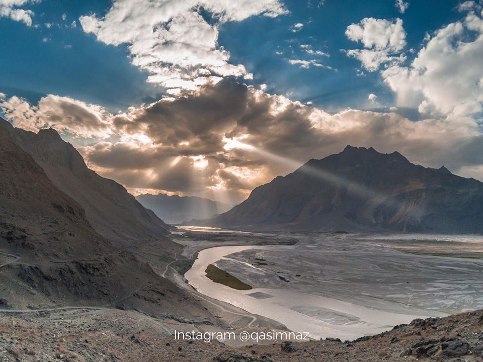
Who can say that this lake was formed as a result of a natural disaster which struck in January 2010? I clicked so many pictures of the blue lake, Attabad in Pakistan. These two places – Attabad Lake and Passu cones were my favorite ever since I read about Pakistan attractions. This was the day I always dreamt about with me in the center, and today, I was living it to the fullest. By the time, I left Attabad with a heavy heart it was already 15.30 hrs. I had seen all the major attractions of Hunza valley. So, I decided to drive up to Gilgit which was another 4 hrs away from Attabad Lake. There were no big towns on the way. River Hunza was a constant companion. At every twist and turn, with the sun shining and hiding behind the clouds, the landscape was changing colors for the better. Karakoram highway added to the splendor of the valley. It is indeed an engineering marvel.

Gilgit, a town in Gilgit-Baltistan, part of the Pakistani-administered sector of the Kashmir region, in the northern Indian subcontinent. It is situated in the Karakoram Range in a narrow valley on the Gilgit River at its confluence with the Hunza River and about 20 miles (32 km) upstream from its confluence with the Indus River.
Source of Information: http://mygilgit.com/gilgit-baltistan/history.php

For the first time in last 8-9 days, I got up so late at 08.00 hrs. The sun was already up, but still it was pretty cold outside. I was mentally planning for the onward journey when I realized that its hardly 5 hrs journey from Gilgit to Skardu. I had almost full day at my disposal. Places I wanted to visit near Skardu were Deosai National Park, Katpana desert, Shigar Valley, Satpara Lake and Shangrila resort. But before I leave Gilgit, I wanted to explore some quiet place next to river Gilgit and relax. I checked out after breakfast and took the road to Naltar valley in the opposite direction. After driving for around 10 km on Naltar valley road, I saw a bend which was broader and I could park my XUV there. There was a narrow path down the cliff which took one to the raging river below. Perhaps this path was being used by locals to cross the river to the other side as I saw a manual pulley rope way. I carried with me a back pack with a novel, ipod, some snacks, water and an umbrella. The path was broken and slippery and one wrong step could have taken me to the river faster, though not in one piece. After walking for down the hill for about 15 mins, I was at the river banks. Water was flowing in full demeanor. The silence of the valley with only sound of water gushing against the rocks soothed my nerves. I needed this alone time, just with nature. So many thoughts engulfed me. My life, my family, my friends, my country and what not. These thoughts were like clouds, they just came and went by and when they did go, it gave me a clearer vision of what I needed from this trip. More than exploring the vistas of nature, I wanted to see and absorb the new culture, interact with people and get to know why are we – Indians and Pakistanis so different, yet so much alike. When my head got clearer, I strolled along the river and as I found a big rock in the middle of stream, I jumped on it. I dipped my feet in the cold water, it was so soothing. The view of the valley was just perfect from this place. It appeared as if I was in the center of the this landscape. I regained my energy and hurried back to my car. It was almost noon when I started to drive to Skardu.After driving for almost an hour on N35, there came a diversion at Jaglot where N35 (Karakoram Highway) turned towards Chilas while S-1, a state highway, took me to Skardu. Here Gilgit river, merged into Indus river.
Skardu the central valley of Gilgit-Baltistan, is an epitome of beauty, serenity and wilderness. Paths to some of the world’s highest mountains that includes K2, K3, and Gasherbrum; all are connected through this valley. These towering mountains attract thousands of climbers from all over the world each year; some have even lost their lives in efforts to summit these steep climbs. After Jaglot on the Karakoram Highway, a narrow road turns towards Skardu.
Source of Information: http://www.skardu.pk/famous-places-skardu/
Chirping birds woke me up literally. It was already sunny though cold at 07.00 hrs. It seemed the Indus river had not slept entire night and was angry at this hour. The sound of water paving its way around the rocks was a magnificent sight, a treat to eyes. All this view, right from my bed was a lavish affair. No wonder these guys charge a bomb for such a basic room. Unfortunately, there is no reliable public transportation in Skardu. Though one can get a cab for full day, which I wasn’t keen. With all these thoughts, I got ready and post breakfast, decided to walk to my first destination of the day… The blue eyed wonder of Skardu… Satpara Lake. Time read 08.00 hrs. They say, water is so blue, it can simply put sky to shame.
Source of Information: https://gbit.pk/10-beautiful-places-visit-shigar-valley-skardu-baltistan/

Time read 16.30 hrs when we reached Shigar fort. Shigar river was gently flowing in the backdrop. This reminded me of the Altit fort of Hunza valley. A similar structure though this has a more muddy soil and looks raw. The photos I clicked here were fantastic, something similar to Lamayuru of Ladakh… brownish tinge in every pic. The fall was almost over and winters had not begun properly. This window of beauty was relatively very small, yet enchanting. It was almost 17.30 hrs when I was ready to head back to Skardu town. I requested my driver to take me to Katpana desert first.
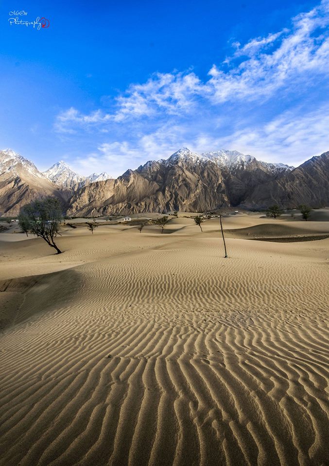
Instead of taking me through the main highway, he took a trail passing through sandy desert and along tributaries of Shigar river. There was no one in sight except sand and mighty Karakoram mountains. My DSLR worked overtime, but owing to horrible condition of trail, most of the photos were shaky. This resembled Hunder desert of Nubra valley of Ladakh. Nature has no bias, it seems. By the time we reached Baghardu, which is close to Katpana desert officially, I had lost all my zeal to click pics and enjoy the cold sand. I asked my cab driver to take me to PTDC as it felt as if sand had smeared my clothes. It was 19.00 hrs when I reached hotel. After a hot shower and delicious wazwan, I retired to bed.
Day 11: Skardu – Gilgit
Since the target drive was of 8 hrs only, I decided to get up late. However, the chirping birds and pristine valley view didn’t allow me. As the sunrays caressed my cheeks early morning, I woke up to most mesmerizing views of the vast expanse of land and mountain. It was pretty cold in the morning, around 6 degC. I ordered a cup of hot coffee which brought me some respite from the chill. A hot shower and two aloo parathas later, I was ready for my return drive, which starts today. The route I had planned to take was Skardu – Jaglot – Chilas – Lulusar Dudipastar National Park – Naran. I bid adieu to the hotel staff with a promise that I’d mention their hotel in my blog (which I did). It was 10.00 am when I started from PTDC Skardu. Since I had full day ahead, I planned to drive slowly enjoying the beautiful weather listening to Mohd. Rafi. As I drove across Skardu, I passed through Skardu airport, which was pretty small in size, resembling Leh air port of India. The backdrops, terrain and facilities, all looked the same.

As I reached Kachura, the beauty of Shangrila resort forced me to stop the XUV and click a few pics. Its owner was Late Brig. Aslam Khan, who was instrumental in bringing Gilgit, Skardu, and Hunza under Pakistan control during the 1947-48 war. Time read 11.00 hrs when I left Shangrila resort. The drive from Skardu to Chilas was on a known terrain. The traffic was thin and the Indus river was a constant companion. The serpentine road turned every now and then keeping a check on XUV’s speed and agility. The only companion I had then was myself and the mellifluous voice of Mohd. Rafi crooning old melodies. The sunroof of XUV was open and chilly wind brushing against me kept me awake. This car has endured all terrains with ease and it really deserved to be one of the top SUVs of India. However, when I thought about the niggles, especially the squeaking sound from the interiors, it abhors me from siding with XUV. Spending more than 20 lakhs and getting plastic interiors is not acceptable. Amidst these thoughts, my mortal emotions returned and I felt hungry. I had almost reached Sassi which was one of the remotest places I had ever seen.
There was a Hydel Power station in Sassi and that’s the only symbol of civilization there. I parked my car along the highway away from the road and took out my foldable chair and table and placed it next to the edge of the road overlooking the view of the valley. Bread, butter, and juice were out and I enjoyed the snack with a perfect view of the valley. I wish I had time to read a novel in this setup, lazying around. I wrapped up and continued my journey. Time read 14.30 hrs. By 15.00 hrs I had joined Karakoram Highway towards Naran. The quality of the road improved considerably and so did XUV’s speed and traffic. This highway is the lifeline of the region with almost all-weather road connectivity. Now the distance was being covered faster. I stopped the car frequently to click pics but soon realized that this passion has to stop or else I’d get really late to reach Naran.
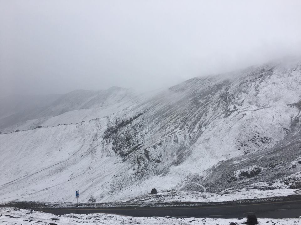
By the time it was 17.00 hrs, I had crossed Chilas and was on my way to Babusar top again. The road was broken and it would soon be dark. Crossing Babusar top and then into Lulusar Dudipastar National park at dusk was not a great idea. For a moment, I thought of staying at Chilas but somehow the hero in me pushed me to cover this distance. I should be out of the National park within 2 hrs. I promised myself that I’d not stop the vehicle inside the forest no matter what. I was stopped at the security checkpoint and was advised to go back as it would get dark soon. I requested the authorities to let me pass as it would otherwise delay my plans to reach Lahore on time. After much pleading, I was allowed to go but the officer asked me to drop his deputy at the other side checkpoint, somewhere near Jalkhand. I agreed. The two of us continued the journey. I was happy that someone local, someone who knew the roads and terrain was accompanying me navigating the forest. I was driving fast with AWD mode on…my Cheetah (XUV) was unruffled. Road or no road, it didn’t bother her. Soon, we crossed the Babusar top. There was snow all around and the outside temperature showed -6°C at 18.00 hrs.
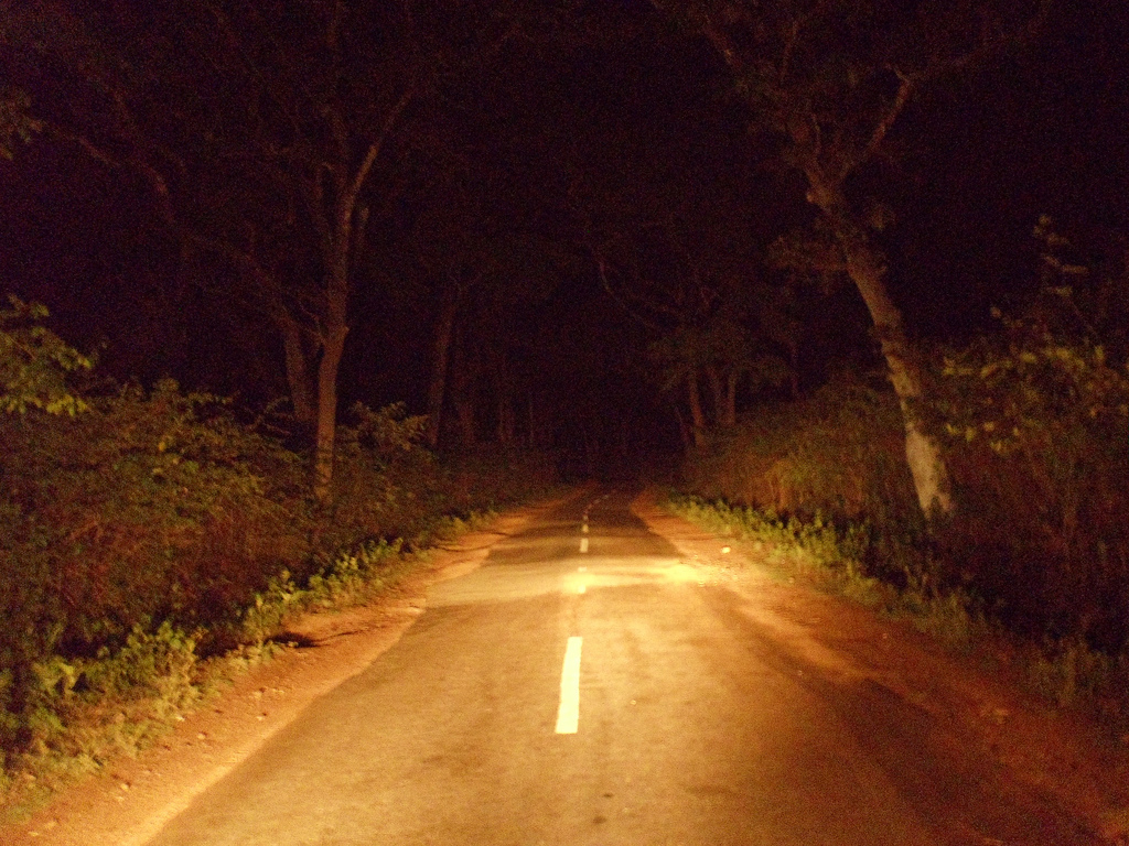
I had to keep running the engine else the diesel may freeze. As we entered the Lulusar Dudipastar National park, the sun had almost set with a faint streak of orange coloring the backdrop of the mountains. It was completely dark within the next 10 mins and ours was the only car which was traversing through this place at this hour. The road was broken at places, it was scary dark and the eerie silence other than the engine’s roar was deafening. A perfect recipe for a horror flick. Slowly yet steadily, we passed the National Park by 19.30 hrs.
I dropped the deputy at Jalkhand. He communicated the safe arrival to his senior at the Babusar checkpoint. I was just one hour from Naran now. By the time clock struck 20.30 hrs, I had entered Naran. On the way, I was told that PTDC Naran offers a comfortable stay and is located on the banks of the Kunhar River. The hotel was empty with hardly 1-2 guests. I was given a cottage at the price of a deluxe room. The weather was bone-chilling despite wearing a jacket and sitting inside the blanket. Upon request, I was given a room heater too. Post dinner, I crashed onto bed. Time read 22.00 hrs.
For tours and travel in Pakistan, you may connect with NARANKAGHANTOURS
Webpage: narankaghantours.com
Contact Number: +92 331 0331 304
To be continued…
Part 1:
Part 2:
Part 3:
Part 4:
One thought on “PANGS OF PARTITION… INDIA-PAKISTAN (PART-5)”